| January 12, 2001 |
|
 |
 |
 |
||
|
|
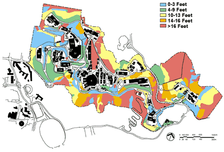
The map
below shows fire risk at Berkeley Lab, represented by wildland flame
heights, as the landscape existed in 1995. Early vegetation
management work included studies to identify targeted areas with
significant fire-hazard potential (see red, orange, and yellow areas) and
subsequent thinning and removal of high-fuel brush and eucalyptus trees.
1995 Flame Heights
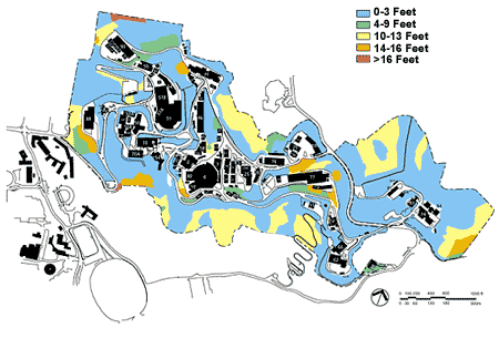
December 2000 Flame Heights
The 2000 map above shows the current flame heights. This reduction in risk was achieved primarily through a mid-canyon fuel break on the Lab's eastern boundary and the use of native perennial grasses in places of high-fuel brushes and shrubs. Note the dramatic reduction in flame height from 1995 with fewer red, orange, and yellow areas.
|